Parcours d’orientation Etang de l’abeille
Approved by the French Orienteering Federation. 4 levels (beginner to advanced): green (3 km) and blue (4.5 km), red (5 km) and black (6.5 km).
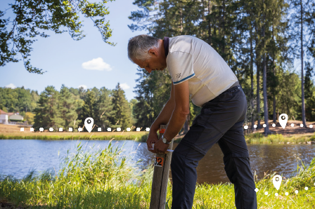
This outdoor activity is carried out with the help of a detailed map. This map allows you to follow a route, with or without a compass, by passing through markers
located on the ground. These markers are numbered wooden posts fitted with a punch. You validate your passage by punching in the scoring grid at each marker.
Provided services
Sport activities
- Orientation hike